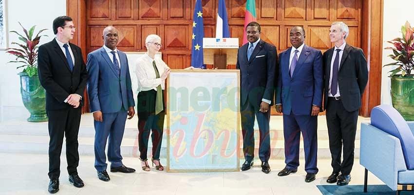
They were handed to the Ministers of Transport and Finance in Yaounde on February 15.
Two marine maps to be used for navigation in the Kribi Deep Seaport have been handed over to the government of Cameroon. The documents the production of which was funded by the French development agency (AFD) were handed to the Minister of Transport, Jean Ernest Ngalle Bibehe Massena and the Minister of Finance, Louis Paul Motaze in a ceremony at the French Embassy in Yaounde on February 15, 2019.
French Ambassador, Gilles Thibault, hailed the company that drew up the maps and noted that the gesture is a demonstration of excellent ties that exist between Cameroon and France. The maps are expected to facilitate the navigation of vessels. The navigation precision tools offered for use at the seaport were designed by a global leader in hydrography and maritime cartography, the Naval Hydrographic and Oceanographic Service, an agency which is said to be the oldest in the world and managed by France’s Ministry of Defence.
"For the Kribi Deep Seaport, there are two maritime maps - a small one and a big one - both designed to ease access to the port. These are part of our contribution to assist the government of Cameroon to make the seaport a leader in the domain in the years to come," said Aude Tychensky, French Maritime Engineer who took part in ...
Cet article complet est réservé aux abonnés
Déjà abonné ? Identifiez-vous >
Accédez en illimité à Cameroon Tribune Digital à partir de 26250 FCFA
Je M'abonne1 minute suffit pour vous abonner à Cameroon Tribune Digital !
- Votre numéro spécial cameroon-tribune en version numérique
- Des encarts
- Des appels d'offres exclusives
- D'avant-première (accès 24h avant la publication)
- Des éditions consultables sur tous supports (smartphone, tablettes, PC)
Reactions
De la meme catégorie
Promotion des indications géographiques : Douala, une boussole pour l’Afrique
- 18 avril 2024 11:28
- 0 likes
Mise à jour des compteurs prépayés d’électricité : des difficultés persistent
- 18 avril 2024 11:26
- 0 likes








Commentaires